![[]](https://www.tanzaniaparks.go.tz./uploads/banner/large_1583321674-banner.JPG)
News


Mt Kilimanjaro Geopark
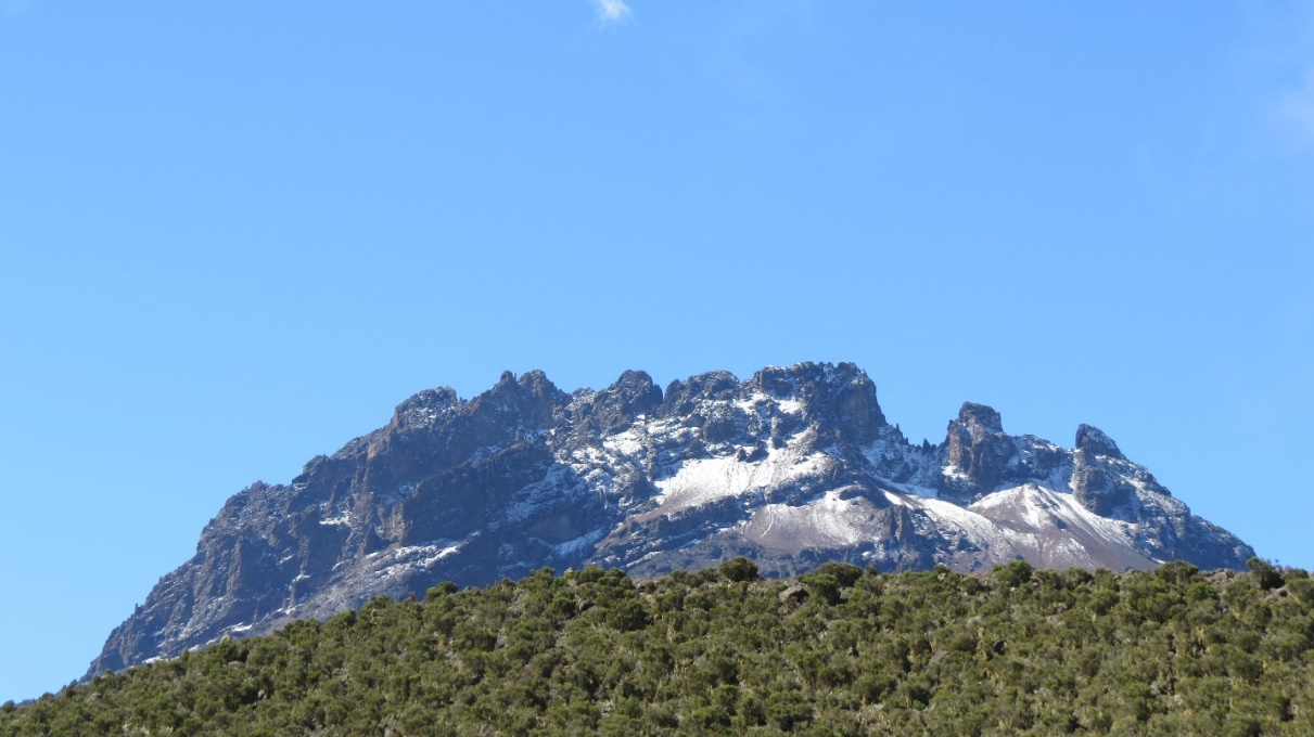
Mount Kilimanjaro is the most prominent feature of Mount Kilimanjaro Geopark. Towering at the height of 5,895M a.s.l, the mountain is Africa’s highest mountain and the world’s largest free standing mountain. Kibo, Mawenzi and Shira are iconic features of the giant and astonishing volcanic mountain.
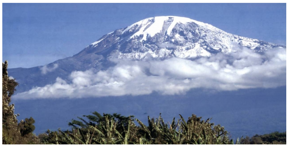
Despite being located near the equator where temperatures are high and snow falling is not typical, the mountain has large expanses of ice glaciers and attracts many visitors from all over the world.
Mt. Kilimanjaro is a critical water catchment for both Tanzania and Kenya. High rainfall and extensive forests belt give its high catchment value accounting for about 96 per cent of flowing water from the mountain. The southern and the south-eastern forested slopes form the main upper catchments of the Pangani River, one of Tanzania’s largest rivers, which drains into the Indian Ocean near Tanga. Its course provides water to the hydropower plants of Nyumba ya Mungu (8 MW), Hale (17 MW) and Pangani Falls (66 MW), which generate some 20 per cent of Tanzania total electricity output. Fishing in Nyumba ya Mungu dam yields a maximum catch of approximately 4,000 tonnes annually. The river also supplies water for large scale farming for lower Moshi rice irrigation scheme. The southern slopes also provide water to Arusha Chini sugarcane plantation. The north-eastern slopes form the catchment of the Tsavo River, a tributary of the Galana River, one of Kenya’s major rivers.
Other attractions within the aspiring geopark include Lake Chala (main crater at the peak of the mountain), parasitic cones and other geological heritages such as the zebra rocks as well several waterfalls,historical sites and cultural value including chagga traditional vessels and boltholes used as means of defense against other tribes especially maasai.
The area has sites and landscapes of international geological significance such as rich aquifer rocks and montane rainforest that produces water which used by the international community (Tanzania and Kenya). Not standing with that, the thick lower montane forests that flourish on a nutritious volcanic soil, contributes greatly as a Carbon sink hence helps in addressing the impacts of global climate change. On other side, sustainable ecotourism and cultural tourism conducted in area has multiplier socio-economic effects that cut across various stakeholders such as Government, private and international community who also participate directly and indirectly in conservation and management of the area. Moreover, the area offers numerous learning opportunities for both local and international community.
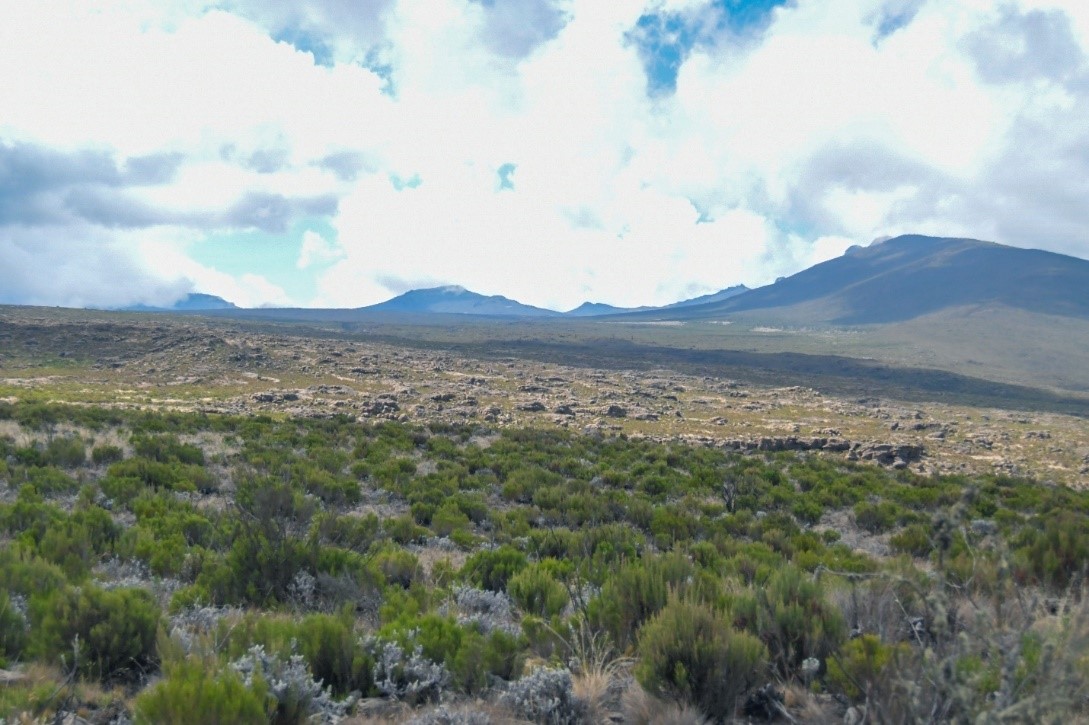
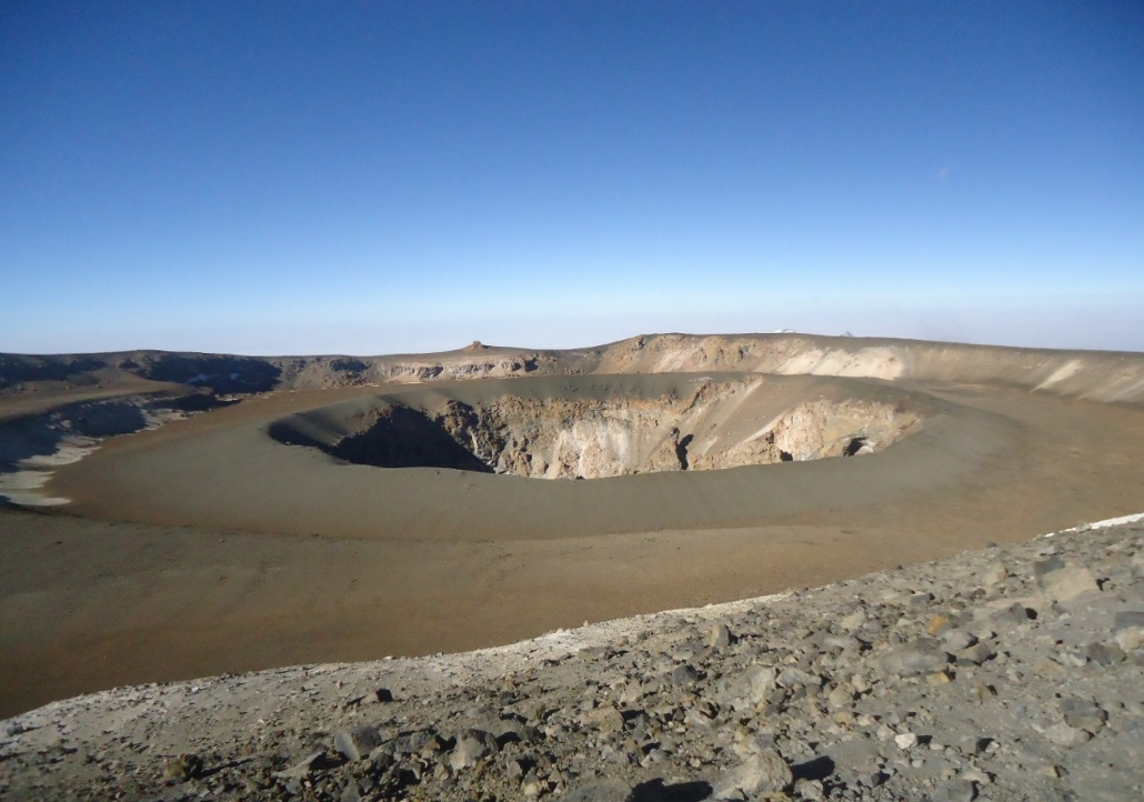
Shira peak (3,962 m), located on the west side of the mountain with remainder of only Western and Southern rims.
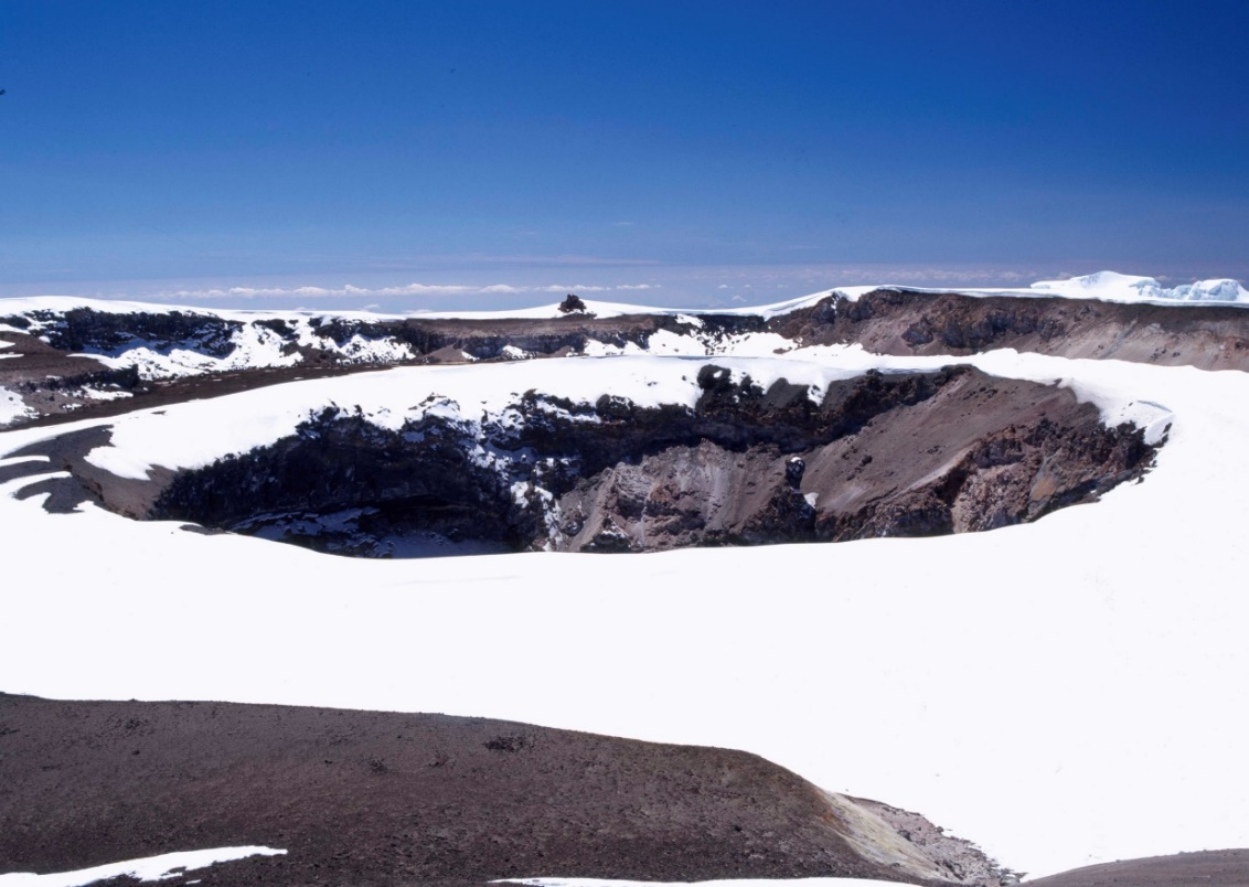
Ash pit showing Reusch Crater
B2.4 The Shira Peaks
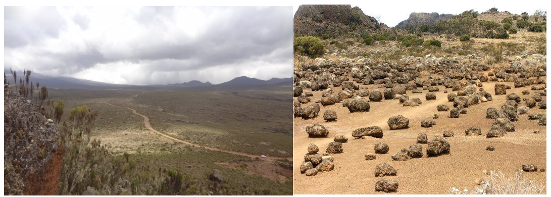
Shira is the oldest and smallest peak on Mount Kilimanjaro. It was the first volcano to erupt and extinct.The highest point of Shira peak is known as Johnsell Point at 3,962m above sea level. Other principal summits of Shira are Klute Peak on the Shira Cone (3840m), Shira Needle, Shira Cathedral and Shira East Hill. The Shira ridge on the Western edge of the mountain is a heavily eroded. This ridge is merely the western and southern rims of the original Shira crater. The northern and eastern sides are covered by later materials from Kibo. Shira plateau is located between Kibo and Shira with extensive plain area of about 6,200 ha which is one of important tourist’s attractions (Plate 6). Visitors from Lemosho and Londorosi route prefers to climb the Shira peak at Cathedral Point (3895m) before proceeding to Kibo peak.
A view of Shira plateau
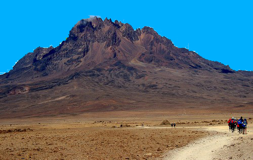
Mawenzi peak (5,149 m), the second highest peak on Mount Kilimanjaro located on the eastern side of the mountain.
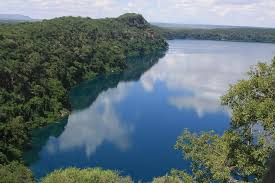
Lake Chala is a water-filled caldera that was formed after volcanic activity (probably from Mount Kilimanjaro) caused it to collapse. The crater itself is 3 km in length and 2.4 km wide, with a surface area of about 4.2 km². The depth of the lake is between 70 to 90m with the walls almost vertical and as high as a 100m in some places. Lake Chala is located some 55km northeast of Moshi town on the south-eastern flank of Mount Kilimanjaro and on the Kenyan border.
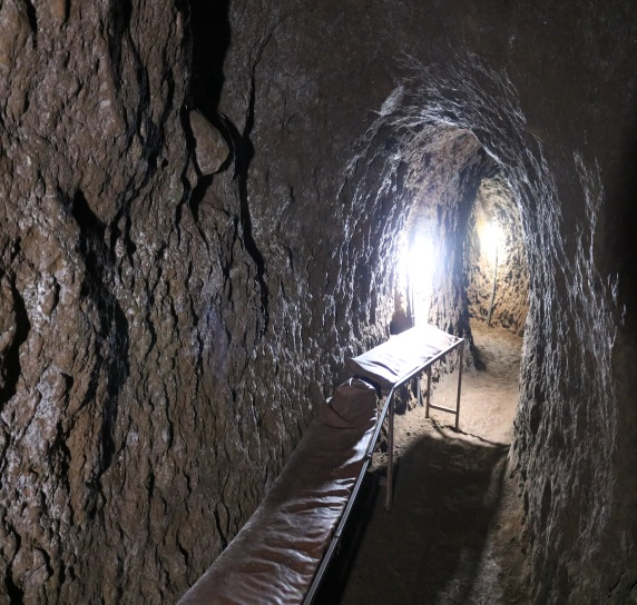
CHAGA ANCIENT CAVE
The Chagga used caves and a system of tunnels for defence during tribal against nomadic tribes. Thesa caves can still be found in numerous areas within the geopark and some are prominent tourist attractions.
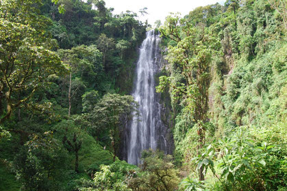
Numerous freshwater springs and waterfalls are among prominent volcanic features in the geopark, Mnambe waterfall being one of them.
Chagga Cultural Heritage
Chagga people are located in the north part of Tanzania, living around base and slopes of Mount Kilimanjaro. They are relatively wealth partly due to favorable climate of the area and successful agricultural methods which include extensive irrigation using traditional canals from the mountain. Chagga people grow bananas, potatoes yarms, beans, peas, red millet, bananas and coffees. Within the Chagga community, there are traditional foods such as Mtori, Kitawa, Macharali, Ng’ande, Kiburu ,kitalolo,kisorombewa, Kiumbo, Ndafu, Ngararimo and Shiro. They brew delicious and famous drink called Mbege which is made of millet and banana and left to ferment for 10 days prior to festivities. Chagga traditional instruments which forms important cultural heritage include wooden flutes, bells and drums (Plate 20). In most Chagga communities, singing are part of almost every celebration.
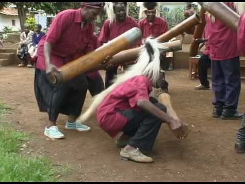
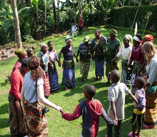
Chagga traditional dances